
Offshore Energy Engineering Policy and Standards
Offshore Wind Environmental Assessment: What Baseline Surveys Cover
An offshore wind farm environmental assessment starts with a practical question: what is present at the site, and how might those conditions change without the project? A useful baseline brings together evidence on habitats, species, underwater sound, water and sediment conditions, and the physical processes that shape them. Its scope should follow the project’s likely impact pathways, including the export cable route and landfall, rather than stop at the boundary of the turbine array.
For technical assessors, the quality of a baseline is judged less by the number of surveys completed than by whether the evidence can support decisions. A survey may identify a sensitive seabed habitat, for example, but still be inadequate for assessing cable installation if it does not establish the habitat’s extent along the proposed route. Seasonal coverage, spatial resolution and uncertainty can be just as consequential as the choice of instrument.
Start with the project footprint and its impact pathways
Baseline surveys establish the environmental conditions against which potential construction, operation, maintenance and decommissioning effects can be assessed. They also inform alternatives, mitigation and, where required, the design of later monitoring. The relevant area varies by receptor: a benthic survey may focus on areas of seabed disturbance, while an assessment of migratory birds or underwater noise may require evidence from a much wider area.
The initial scope should reflect the activities under consideration. Foundation installation, cable burial, seabed preparation and vessel movements create different pressures. An assessment that considers only the turbine locations can miss habitats on an export cable corridor or receptors exposed outside the development boundary. Equally, a large survey area is not automatically sufficient if the sampling design does not resolve the features likely to be affected.
Existing environmental records can help identify sensitivities and guide fieldwork, but their suitability depends on location, age, methods and the question being asked. Data collected for a broad regional study may provide context without resolving the condition of a particular cable crossing or foundation area.
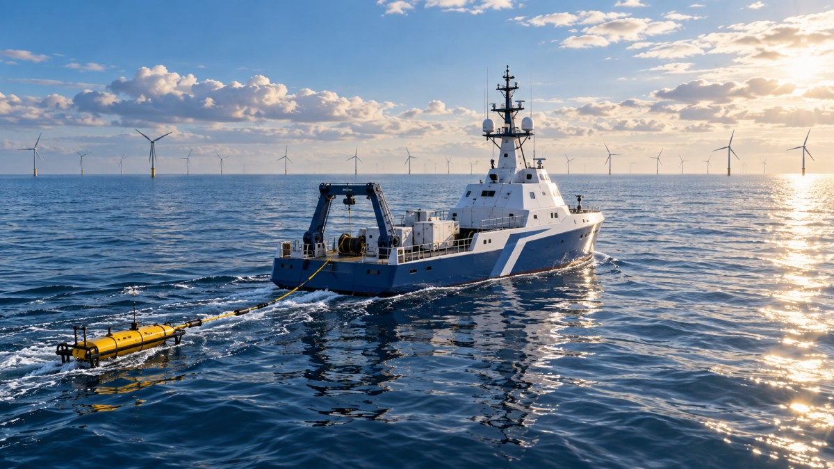
What the main baseline surveys measure
Seabed habitats and sediments
Benthic surveys describe the seabed and the communities living on or within it. Geophysical mapping can show seabed features and changes in sediment character; grab samples, cores, video or still imagery can then be used to interpret those features and identify habitats and organisms. The combination matters because acoustic data alone may not reliably distinguish habitats with similar physical signatures.
Assessors should look for a clear link between the mapped habitat and the samples used to validate it. Sampling should address areas likely to be disturbed as well as the range of habitats identified across the survey area. Patchy or sensitive features can be missed when sample locations are too widely spaced. The resulting uncertainty matters when estimating habitat loss, selecting a cable route or deciding whether a feature can be avoided.
Sediment samples may also support assessment of grain size, contaminants and other properties relevant to disturbance. The analysis should be selected in relation to local conditions and proposed works: sediment resuspension, for instance, may carry different implications where contaminated material is present. A habitat map is therefore only one part of the evidence needed to assess seabed disturbance.
Marine mammals and other mobile species
Marine mammal baseline work aims to establish which species occur in the area, how their presence varies, and whether the site or surrounding waters may support feeding, breeding, migration or other important activity. Depending on the species and setting, evidence may include visual observations, aerial surveys, passive acoustic monitoring and existing records.
Each method has detection limits. Visual surveys depend on conditions such as visibility and sea state; acoustic monitoring detects vocal activity rather than every animal present. A period with few detections does not necessarily demonstrate absence. Assessors should examine survey effort, coverage, detection limitations and whether the methods are appropriate for the species in question.
The baseline also provides inputs for assessing exposure to underwater sound from activities such as foundation installation. That requires more than a species list: the assessment needs a defensible account of occurrence across the area where sound could be relevant, alongside uncertainty about animal distribution and behaviour.
Birds and bats
Bird surveys typically seek to characterize species, abundance, distribution and seasonal use of the area. Depending on the assessment, information on flight behaviour and height can support analysis of collision risk or displacement. Survey design should reflect the species and pathways of concern, including movement between breeding, feeding and resting areas where relevant.
Timing is especially important. A survey undertaken outside migration or breeding periods may miss a substantial part of a site’s use. Detection and identification also vary with survey method, weather and observer or image resolution. Assessors should check whether estimates represent observed birds, modelled abundance or another measure, and whether uncertainty is carried into subsequent impact calculations.
Bat activity may also need consideration where species, migration routes and local requirements make it relevant. Its inclusion and methods should be determined through site-specific scoping rather than assumed for every offshore development.
Fish, shellfish and wider ecological relationships
Fish and shellfish evidence can cover species composition, distribution and the presence of spawning or nursery grounds. Existing fisheries and ecological datasets may provide a starting point, supplemented by field sampling where they cannot answer the assessment questions. The choice of gear affects what can be detected: one method may sample seabed-associated species well while providing limited information on species higher in the water column.
Interpretation should consider life stage and season. An area may be important during a spawning period even if sampling at another time records relatively few adults. Potential effects can also extend beyond direct disturbance: changes to prey, habitat or sound exposure may affect ecological relationships. Where the assessment relies on inferred habitat suitability rather than direct observation, that distinction should be explicit.
Underwater noise, water quality and physical processes
Underwater acoustic measurements characterize the existing sound environment and can identify natural and human sources, including vessel traffic. Measurement locations and recording periods influence the result: a short deployment may capture a passing vessel without representing quieter conditions, or miss an intermittent source altogether. Baseline sound measurements are useful context for an impact assessment, but they do not replace modelling or measurement of the sound generated by the proposed activity.
Water-quality surveys may measure properties relevant to the project and local receptors, such as suspended sediment or dissolved oxygen. Because these conditions change with tides, weather and seasons, an isolated sample should not be treated as a complete description of normal variability. The assessment should explain how measurements relate to the conditions under which construction could occur.
Physical-process studies examine features such as tides, currents, waves and sediment transport where they are relevant to seabed change, scour or sediment dispersion. These studies can draw on measurements, existing datasets and models. Their value depends on whether the spatial coverage, time period and assumptions are suitable for the proposed works and the receptors being assessed.
How to judge whether the evidence is fit for assessment
A baseline is a representation of changing conditions, not a single definitive snapshot. The assessment should distinguish observed data from modelled estimates and explain where evidence has been extrapolated beyond the sampled area or period. A survey can be technically sound and still leave a material gap if it misses a sensitive season, a proposed route option or a species that is difficult to detect.
Several checks help determine whether that gap matters to a decision:
- Spatial coverage: Does the evidence cover the array, cable corridor, landfall and wider area relevant to each impact pathway?
- Temporal coverage: Were important seasonal uses and changing physical conditions represented, and are older records still applicable?
- Detection and resolution: Could the method detect the species or habitat feature at the scale needed for the decision?
- Data integration: Do field observations, existing records and models agree? If not, is the difference explained?
- Traceability: Are sampling locations, effort, methods, quality controls and limitations documented well enough for the assessment to be reviewed?
Uncertainty should be carried through to the impact assessment rather than disappear when baseline findings are summarized. If habitat boundaries are uncertain, for example, the estimated area affected should reflect that uncertainty. If marine mammal occurrence is poorly resolved in a season when noisy construction is proposed, the assessment may need additional evidence, a precautionary assumption or a change to the activity being assessed.
From baseline findings to project decisions
Baseline work is most useful when it is coordinated with engineering while options remain open. A mapped habitat may inform foundation placement or cable routing; seasonal species data may influence the construction programme; sediment and current information may affect the assessment of cable installation methods. Early findings can also identify where the project description is too uncertain to define a credible survey scope.
There is a scheduling consequence. Some ecological questions require observations across specific seasons, and an inadequate initial scope can leave a gap that cannot be closed immediately. Conversely, collecting extensive data without agreement on the relevant assessment questions can add effort without resolving a permitting issue. Early engagement with the relevant authorities and technical advisers can help align methods, geographic coverage and evidence expectations with local requirements.
The baseline should remain connected to the final project design. If a cable corridor moves, foundation types change or installation methods are revised, assessors should revisit whether the surveyed area and impact assumptions still apply. The decision is not simply whether a baseline survey exists, but whether its evidence remains adequate for the project that is actually being assessed.
- Last One:Offshore Wind Farm Permitting: Mapping Approvals and Project Risks2026-11-12
- Next Article:No more articles
Tag
Recommended for You
{item.title}
News Categories
Leave Us a Message